Photographic documents from the past
We inaugurate this section of images that show the changing countryside in the As Mariñas area of A Coruña (Galicia, Spain). In some cases they demonstrate the disappearance of natural habitats; in others, they show how neglect or a change in the use of arable land led to an increase of forests on the river banks.

The view west of Betanzos, circa 1904.
By: Francisco Javier Martinez Santiso.
In this picture we can see the old course of the River Mandeo, bending towards the Northwest to merge with the River Mendo at the Ponte Nova, and then turning Southwest to flow into A Cangrexeira. This photograph was taken when the filling-in work to build the station and the railway had already started, distinguishable on the left of the image. On the right one can see the old Ponte Nova (New Bridge), now replaced by a concrete bridge. All the river bed and reed area visible were filled in, becoming the location for a secondary school and the Pablo Iglesias Park.

The view east of Betanzos, circa 1925.
By: Anonymous
Marshland loss due to the town’s expansion also affected the A Ribeira neighbourhood. In this picture we can see the Matadero building (the old slaughterhouse) bordering the reeds. Nowadays, all this area is built-up and the river flows hemmed in by an embankment. Now and then the floods coincide with the spring tides to reclaim this space.

The view southeast of Betanzos, circa 1965.
By: Anonymous
In this picture you can see the River Mandeo entering the town, the reeds of A Veiga on the right bank still perfectly preserved. On the slopes of the left bank you can see hops being grown on poles, and also in a fluvial terrace next to A Cañota Street.

Views of the River Mandeo, circa 1960.
By: Anonymous.
The use of space was intensive until the mid 60s, as shown on this photograph. The vineyards came up to the very river bank. The chestnut trees were pruned to use the branches as fuel in kitchens.

Os Caneiros fiesta, circa 1900.
By: Avrillon (Imprenta Ferrer).
The dense forests of pines and eucalyptus currently surrounding the field of Os Caneiros were in other times arable land. In this image we can see a lonely tree growing on the right river bank, in the background the arable lands of Paderne Municipality. This image corresponds to a time in which land agricultural use was maximized to cope with the needs of a population that had already reached the limits of sustainability of the area.

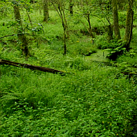
Views of Chelo, 1971.
Author: Carlos Silvar.
In this picture we can see how social changes at the time affected the composition of our woods. The eucalyptus was colonizing the area around Chelo as the land least suited to cultivation was being abandoned, and then it spread spontaneously. The native forest was thus relegated to the most abrupt banks of the River Mandeo.
It’s hard to find photographs prior to the 60s that clearly show land use in the Betanzos estuary and on the banks of the Mandeo and Mendo. Reproduction of these images was made possible through the courtesy of the Arquivo Municipal de Betanzos (Betanzos Council Archives).
Do not hesitate to contact us if you can provide interesting images. In section Contact you’ll find all the necessary information.